


Plan views are horizontal displays of two dimensional data. These data can be true 2D fields (e.g., sea level pressure) or a slice of a 3D dataset at a constant pressure or height (e.g., 500 hPa heights). The IDV can display these plan views as contours, color filled contours, or color shaded displays.
Edit→Remove All Displays menu to remove the displays
created in the previous exercise. Set the viewpoint to the
top.
Field Selector's
Data Sources panel, select
the NCEP Model Data ETA data source
that you loaded in during the previous exercise.Fields panel,
expand the 2D grid tab. Select the
mean sea level pressure (ETA model reduction)
field.Displays panel, select
Contour Plan View then click
the Create Display button. The
data will be read from the remote server and displayed in the main
map window of the IDV.Change
button next to the Contour: label to open the
Contour Properties Editor. In the
editor, change the contour interval to
2 and click the OK button.Field Selector's
Fields panel, select the
total precipitation over accumulation interval
field.Displays panel of the
Field Selector, select
Color-Filled Contour Plan View and
then click the Create Display button.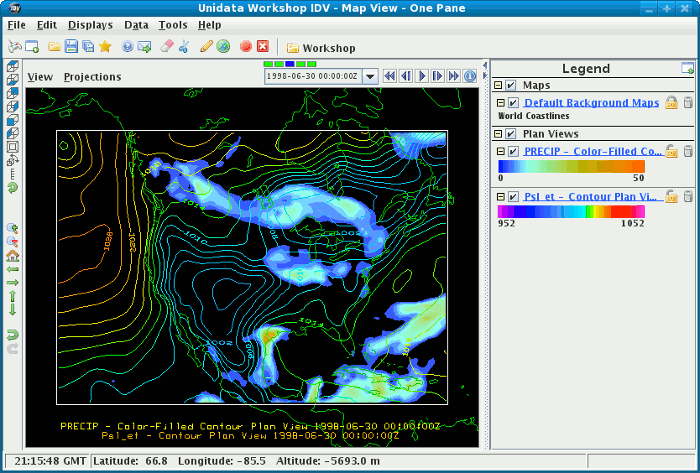
Fields panel, expand
the 3D grid tab.
Select the geopotential height field.Displays panel, select
Contour Plan View.Data Subset panel, select
Level tab and select the 500 hectopascal level
then click the Create Display button.Levels selector.
