


The Range Rings are oriented with local north-south on the displayed map projection. In some cases the eastward radial line may not be horizontal.
You display Range Rings from the main menu with the
Displays->Special->Range Rings menu. The Range Rings
will appear centered on the map projection. You can move them by
resetting the latitude-longitude or station as described below.
The IDV can display several radar images at once, and range rings can
be displayed for each one. You may display as many range rings at one
time as you like, centered anywhere, not just radar locations.
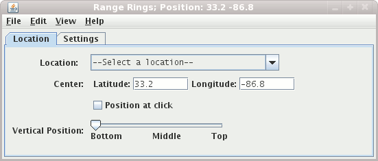
The position of the center of the rings is shown in the text fields
Center latitude and Center longitude
To re-center the rings, you can select a radar station by name from the
pull-down list, or you give new lat/lon values by entering values in a
text field and pressing return. Note: west longitudes are negative.
When this check box is selected the range rings will be centered where you click in the main display
This slider allows you to set the vertical position of the Range Rings.
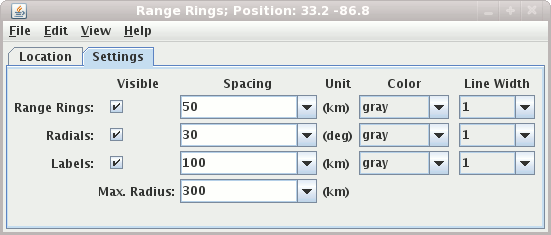
You can toggle the visibility of the range rings, labels, and radials
on and off with the Visible checkboxes. To toggle the
entire radar grid at once, use View->Visible checkbox menu.
You can change the ring spacing, the label spacing, and the azimuth
interval of the radials, using the control window. The values appear in
the text fields under Spacing. You can give
new values two ways: enter a new value in the text field by clicking in
the field, entering the new value, and pressing Enter, or click on the
pull-down arrow on the right side of the text field to see a list of
common values.
You can change the color of the lines and labels with the
Color pull-down lists.
You can change the width of the lines and labels with the
Line Width pull-down lists.