

 Unidata's Integrated Data Viewer > Main Window

4.6 Flythrough
The Map views have a "Flythrough" facility that allows for flying through a 3D View.
This is accessed through the menu.
The Flythrough operates in 2 modes - first the user can just bring up the Flythrough dialog
and fly around the view interactively. The second mode is to define a set of points which defines
the path to follow.
The Flythrough dialog consists of a set of tabs and flythrough controls.
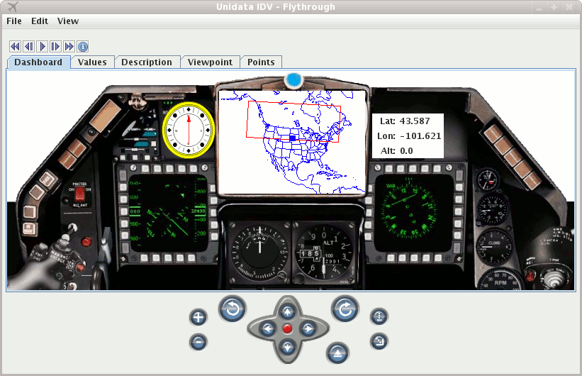
The first tab is the Dashboard which gives a simulacrum of an airplane dashboard:
 Image 1: Flythrough Dashboard
Controlling the Viewpoint
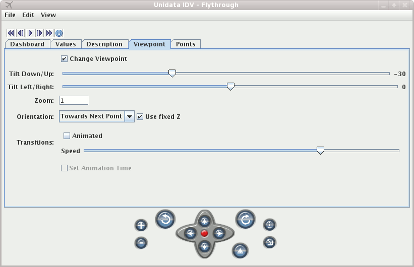
The Viewpoint tab allows you to control the viewpoint of the flythrough. You can control the orientation, zoom and the animation
of the transitions.
 Image 2: Flythrough Viewpoint
The other tabs will show text descriptions of the points, probed values and the actual points of the track.
You can export and import the set of points in a flythrough with the menu.
This is a simple xml format that
Probing Data
If there are other displays in the same view that have data then as one flys through the view
the data will be sampled at the location of the flythrough and be shown as gauges in the dashboard.
The actual values will be listed under the Values tab. This operates the same way as when one interactively
does a middle-mouse drag in the view. The IDV samples the data at the latitude/longitude/altitude of
the flythrough point and the current animation time. A time series chart will also be shown in the dashboard
(you might have to enlarge the window to see it.
Background Images
If you have the IDV webcam display being shown then the nearest image to the current flythrough
point will be shown as a background image in the Dashboard tab. This can be turned off
with the menu item.
Flying along a Trajectory
The other to flythrough a view is by flying along a trajectory, i.e., a set of points in
3D space and (possibly) time. The set of points can come from a number of sources:
- Storm Track Display Control: In the Table view the Flythrough button (lower right) will use the points of the
current storm track.
- Track Control: Use the menu to fly along the track.
- Drawing Control: For polygons that are drawn you can fly along them with Control-F (for the selected polygon) or
from the polygon's properties dialog.
- Station Locations: Use the menu to fly from location to location.


 Unidata's Integrated Data Viewer > Main Window


