


 |
GRDLIST BLIZZARD/GRIDS NUM=ALL FORM=FILE
DATASET NAME: BLIZZARD/GRIDS
 Dataset Position  Creation Date Max Grids         Directory Title
 ----------------  ------------- --------- -------------------------------
        1             1993070        159   12Z 93070 NMC NGM TRAINING GRID
        2             1993071        159   00Z 93071 NMC NGM TRAINING GRID
        3             1993071        159   12Z 93071 NMC NGM TRAINING GRID
        4             1993072        159   00Z 93072 NMC NGM TRAINING GRID
        5             1993072        159   12Z 93072 NMC NGM TRAINING GRID
|
|
| |
GRDLIST BLIZZARD/GRIDS.1 GRID=1 FORM=ALL Dataset position 1 Directory Title= 12Z 93070 NMC NGM TRAINING GRID PARAM LEVEL DAY TIME SRC FHOUR FDAY FTIME GRID PRO ----- ------- ------------ -------- ---- ----- ------------ -------- ------ ---- Z 1000 MB 11 MAR 93070 12:00:00 ROI 0 11 MAR 93070 12:00:00 1 MERC Total pts= 1188 Num rows= 33 Num columns= 36 received: 0 000000Z No GRIB number information Units of gridded variable are GPM Scale of variable is: 2 Mercator Projection Min Lat= 20.00 Max Lat= 60.00 Min Lon= 52.50 Max Lon= 140.00 Latitude Increment= 1.2500 Longitude Increment= 2.5000 Number of grids listed = 1 |
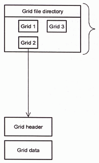
The GRDINFO command provides information about grids. You can use it to list information about the grid header and statistics on the grid data, or list data points.
The GRDLIST and GRDCOPY commands can also manipulate grid files. With these commands you can create, list, or copy a grid file.
| ADDE Dataset | Description | ADDE Dataset |
| RTGRIDS/ALL | All model grids decoded by McIDAS-XCD | RTGRIBS/ALL |
| RTGRIDS/AWC-ALL | National Convective Weather Diagnostic grids | RTGRIBS/AWC-ALL |
| RTGRIDS/AWR-ALL | Alaska Waters Regional Wave Model grids | RTGRIBS/AWR-ALL |
| RTGRIDS/ECM-ALL | European Cntr for Med range Weather Forecasting grids | RTGRIBS/ECM-ALL |
| RTGRIDS/ENP-ALL | Eastern North Pacific Regional Wave Model grids | RTGRIBS/ENP-ALL |
| RTGRIDS/FFG-ALL | NWS Flash Flood Guidance System grids | RTGRIBS/FFG-ALL |
| RTGRIDS/GFS-ALL | Global Forecast System grids | RTGRIBS/GFS-ALL |
| RTGRIDS/ICA-ALL | Ice Concentration Analysis grids | RTGRIBS/ICA-ALL |
| RTGRIDS/ICN-ALL | Current Icing Potential grids | RTGRIBS/ICN-ALL |
| RTGRIDS/MDR-ALL | Manually Digitized Radar grids | RTGRIBS/MDR-ALL |
| RTGRIDS/NAH-ALL | North Atlantic Hurricane Wave Model grids | RTGRIBS/NAH-ALL |
| RTGRIDS/NAM-ALL | North American Mesoscale Model grids | RTGRIBS/NAM-ALL |
| RTGRIDS/NCE-ALL | NCEP quantitative precipitation forecast grids | RTGRIBS/NCE-ALL |
| RTGRIDS/NGM-ALL | Nested Grid Model grids | RTGRIBS/NGM-ALL |
| RTGRIDS/NPH-ALL | North Pacific Hurricane Wave Model grids | RTGRIBS/NPH-ALL |
| RTGRIDS/RCM-ALL | Radar Code Message grids | RTGRIBS/RCM-ALL |
| RTGRIDS/RFC-ALL | River Forecast Center mosaic grids | RTGRIBS/RFC-ALL |
| RTGRIDS/RUC-ALL | Rapid Update Cycle model grids | RTGRIBS/RUC-ALL |
| RTGRIDS/SST-ALL | Sea Surface Temp Analysis grids | RTGRIBS/SST-ALL |
| RTGRIDS/UKM-ALL | Global Coastal Ocean Circulation grids | RTGRIBS/UKM-ALL |
| RTGRIDS/WHG-ALL | Great Lakes wind wave height grids | RTGRIBS/WHG-ALL |
| RTGRIDS/WNA-ALL | Western North Atlantic Regional Wave Model grids | RTGRIBS/WNA-ALL |
| RTGRIDS/WWF-ALL | Global Wind-Wave Forecast grids | RTGRIBS/WWF-ALL |
As can be seen from the table, she same model data is available through the ADDE GRIB server. The only difference is the use of RTGRIBS for the group name from the GRIB server as opposed to RTGRIDS for data from the GRID server.