


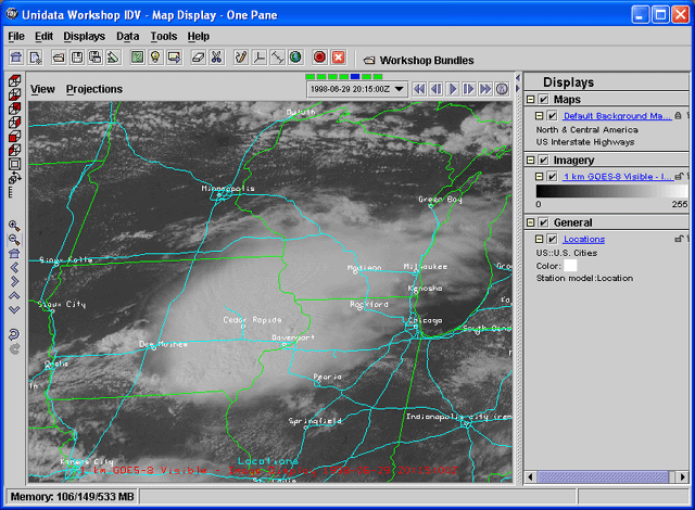
First, we'll load in some visible imagery from the Bow Echo Case Study that we used in the Gridded Data section of the workshop.
Edit→Remove All Displays and Data menu item
or the  icon in the toolbar to clear them out.
Data Choosers.  Click on the
 Images node in the chooser tree.Server: selector, choose
adde.ucar.edu.
In the Dataset: selector, choose
CCS039. If either of these is
not in the list, just type them in. When you have made
your selections, click the Connect
button.Image Type: selector, choose
the 1 km GOES-8 Visible type.Absolute times radio button.
When this option is selected, the server is queried for a set of
available times for that type and these are listed in the
Times: panel.
the 7 images from 1998-06-29 16:15:00Z
through 1998-06-29 22:15:00Z.Add Source button.In the Data Subset panel, there are Times, Region, and Advanced tabs.
Region tab, click on the drop down menu button and
by default the Use Default Region option is selected. Create Display button. The images created in the Map View window
cover the entire region of the dataset. Zoom in over the super cell in eastern IowaTrash icon in the legend panelRegion tab, click on the drop down menu button and
choose the Select A Region option. Create Display button.Map View window, zoom into the region in eastern Iowa covered with the convective cloud. Trash icon in the legend panel, do not
change the map view region in the Map View window.Region tab,
click on the drop down menu button and choose the Match Display Region option, click
the Create Display button.Default Background Maps Control.
Turn on the
North & Central America and
the US Interstate Highways maps.
Make sure all other maps are off. When you are finished,
go back to the View Window.Displays→Locations→US→U.S. Cities menu to
overlay some place names. Change the color of the location
text to be white using the display control's
Edit→Color menu.
Pixel Sampling slider
to see what the image would look like at a lower resolution.